Indoor Navigation for Airports - No Code - No Hardware
NewNovember 2026
New: indoor navigation in chat and WhatsApp
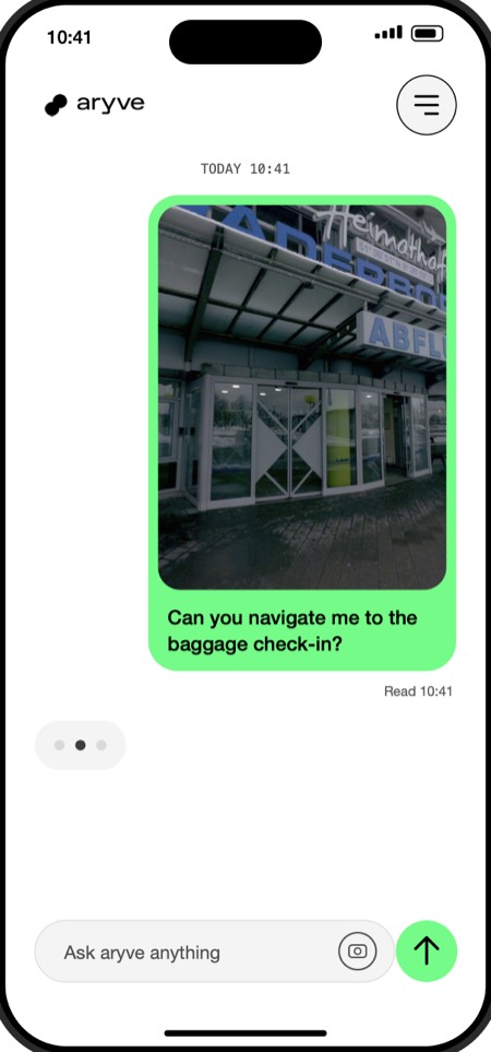
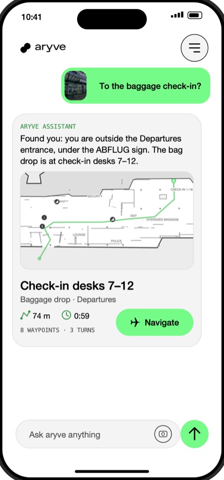
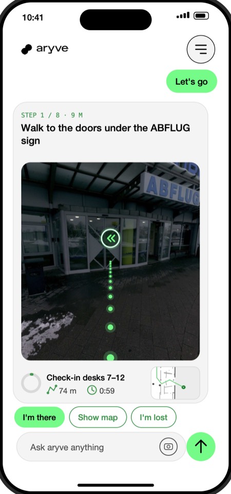
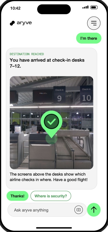
Passengers can now find their way through the terminal in a chat. They send one photo of where they are and ask for a place. aryve finds the position from the image, replies with the route and guides them waypoint by waypoint, in the airport website chat or in WhatsApp. No app, no beacons.
- Send a photo and ask, for example for the baggage check-in
- Get the route as a reply, with distance, walking time and waypoints
- Follow one message per waypoint until you arrive
Three Steps to a Seamless Terminal
Digital Mapping
We create a high-precision visual fingerprint of your space.
Instant Integration
Connect your data to our CMS—no complex coding required.
Go Live
Launch a reliable, multi-user journey that guides everyone to their destination.
Indoor Navigation is Broken.
We're Here to Fix It.
The GPS Black Hole
The Hardware Trap
Low Precision, High Friction
Complex Deployment
Limited by Design
Enter the Era of Hardware-Free Precision.
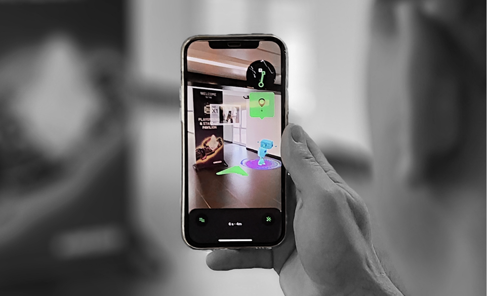
aryve is the first Visual Positioning System (VPS) designed for the scale and rigor of the aviation industry. We’ve eliminated the need for physical infrastructure: one camera image positions passengers to 10–30 cm in 1–3 seconds.
Hardware-Free
No beacons, no cables, no maintenance.
Diverse Applications
Support a range of user journeys and operational purposes.
Simple Setup
Deploy and manage your entire venue via an intuitive code-free CMS.
Centimeter Precision
Accurate to 10–30 cm: enough for passengers, staff, and even autonomous robots.
Scalable by Design
From a single gate to a multi-terminal ecosystem, we grow with you.
Empower Every Stakeholder
For Airport Operators
Reduce congestion and eliminate "gate stress."
For Airlines
Improve On-Time Performance (OTP).
For Service Providers
Optimize staff workflows in real-time.
For Engineering, Procurement, and Construction Companies
Align physical sites with Digital Twins.
Frequently Asked Questions
Camera-based indoor navigation for airports, explained in short answers.
What is aryve?
aryve is a Visual Positioning System (VPS) for indoor navigation, built for airports. One camera image positions a passenger to 10–30 cm in 1–3 seconds, without beacons, Wi-Fi tags or any other hardware.
How does camera-based indoor navigation work?
The passenger opens a web link, for example from a QR code or the airport website, and takes one photo. aryve compares it with the digital twin of the terminal, returns the position in seconds and guides the passenger step by step to the destination.
Do passengers need to download an app?
No. aryve runs in the mobile web browser and uses the phone camera, so passengers can start navigating on their first visit without installing anything.
Does aryve need beacons or other hardware in the terminal?
No. There are no beacons, Wi-Fi tags, cables or cameras to install or maintain. aryve scans the terminal once to create a visual map, and positioning comes from the passenger's phone camera.
How accurate is aryve indoors?
aryve is accurate to 10–30 cm indoors, where GPS does not work. That is precise enough for passengers, staff and even autonomous robots.
How fast can an airport go live with aryve?
At Paderborn/Lippstadt Airport, aryve scanned the terminal and went live within 48 hours, with zero hours of work from the airport's IT team. The only requirement was a standard filming permit.
Where is aryve already in use?
aryve is in live operation at Paderborn/Lippstadt Airport (PAD), Germany's Innovation Airport, where passengers can follow their full journey from check-in through security and retail to the gate.
Who is aryve for?
aryve serves airport operators, airlines, airport service providers and engineering, procurement and construction (EPC) companies. The same platform also works in shopping malls and museums.
Don't Let Your Infrastructure Fall Behind.
Get started today to secure your spot at the forefront of aviation innovation.