
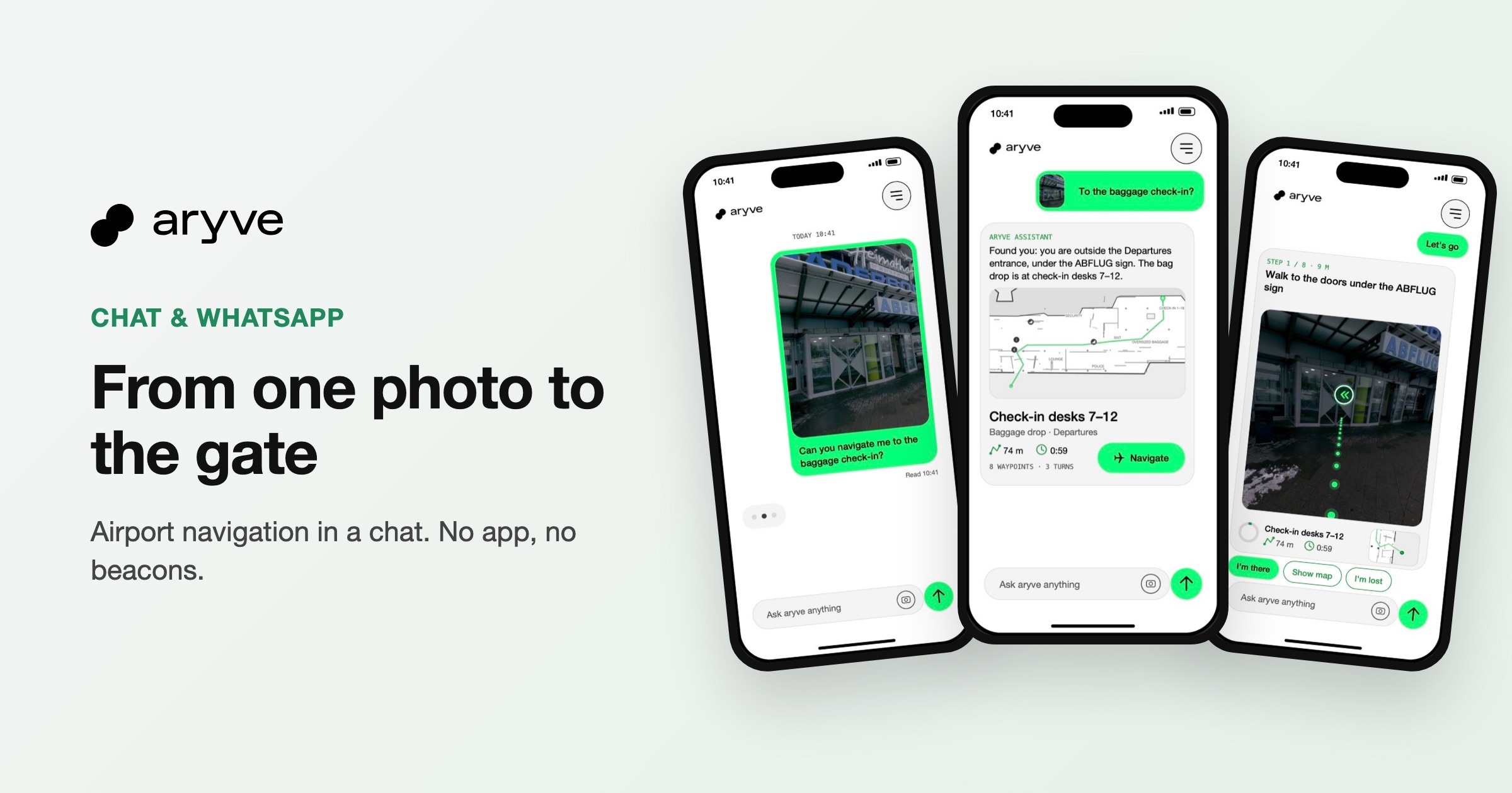
Passengers can now find their way through an airport terminal in a chat. They send one photo of where they are and ask for a place, for example the baggage check-in. aryve finds their position from the image, replies with the route and then guides them waypoint by waypoint until they arrive. It works in the chat on the airport website or in WhatsApp, with no app to download and no beacons in the terminal.
How chat navigation works
The whole journey takes place in one conversation. The passenger does not need to learn a new interface, because it works like any other chat.
1. Send a photo and ask
The passenger takes one picture of the surroundings and types a question such as "Can you navigate me to the baggage check-in?".
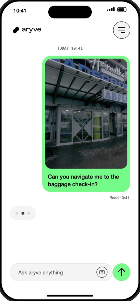
2. Get the route as a reply
aryve compares the photo with the digital twin of the terminal and finds the passenger's position in 1 to 3 seconds. The reply contains the route with distance, walking time and the waypoints on the way.
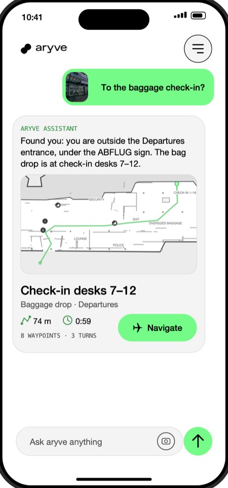
3. Follow one message per waypoint
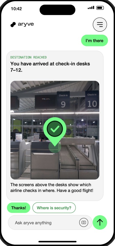
For every waypoint the passenger gets one message, with the view from that spot and the way ahead drawn into the image. A tap on "I'm there" brings the next step.
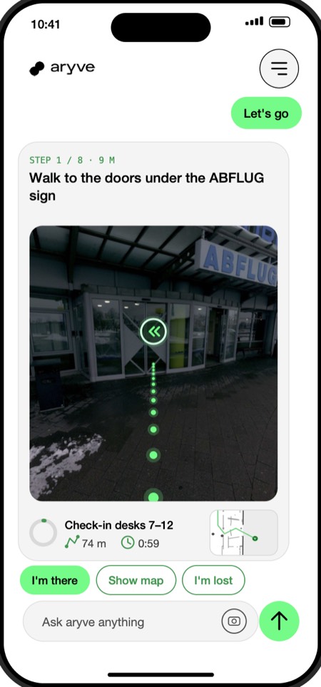
At the destination, aryve confirms the arrival and adds useful information, for example which airline checks in at which desk.
Why chat instead of an app
Most passengers visit an airport only a few times a year. Few of them download an airport app just to find a gate, a check-in desk or a lounge. Chat removes that step:
- No download. Passengers start from the chat on the airport website, from a QR code in the terminal or from WhatsApp, which most of them already use.
- Works on the first visit. First-time visitors and transfer passengers in an unfamiliar hub get help straight away.
- Familiar to everyone. Writing a message and sending a photo needs no explanation, in any language.
- One channel for questions and directions. The same chat can answer questions about the airport and then lead the way.
The technology behind it
aryve is a Visual Positioning System (VPS). Instead of beacons or Wi-Fi signals, it uses the passenger's phone camera. The terminal is scanned once to create a digital twin. Each photo is compared with this twin to find the exact position:
- 10 to 30 cm positioning accuracy indoors, where GPS does not work
- 1 to 3 seconds from one photo to a position
- No hardware: no beacons, cables or Wi-Fi tags to install or maintain
The same digital twin powers navigation in the browser, in the chat and in WhatsApp, as well as audio guidance for blind and low-vision passengers and step-free routes for passengers with reduced mobility.
What an airport needs to get started
An airport needs a scan of the terminal and a chat channel: the chat on its own website, WhatsApp, or both. At Paderborn/Lippstadt Airport, aryve scanned the terminal and went live within 48 hours, with zero hours of work from the airport's IT team. A pilot usually starts with one zone, for example a pier or a transfer area.
Frequently asked questions
Do passengers need to install an app?
No. Chat navigation runs in the chat on the airport website or in WhatsApp. Passengers only need their phone camera.
How accurate is the position?
aryve positions passengers to about 10 to 30 centimetres from one photo, in 1 to 3 seconds.
What happens to the photos?
People in the image are blurred on the device and only coordinates are returned. aryve can run in the public or private cloud or on premise at the airport.
See it for your terminal
Chat navigation is one of thirteen use cases airports run on the same digital twin. See chat navigation and the other use cases for airports, or talk to us about a pilot in one zone of your terminal.